
Sources Around Watertown Neighbors
The most useful block view comes from parcel adjacency. Watertown's assessor results describe each property, while the GIS shows how parcel shapes meet. Deeds can resolve a legal ownership question. The voter lookup answers a precise registration query only when the searcher already has a town, name, and full date of birth. Historical directories and local newspapers help with a past block, but no official current roster of everyone living nearby was found.
| Source | What It Shows About a Block | Access |
|---|---|---|
| Watertown GIS | Parcel shapes, map position, roads, and adjacent lots | Free viewer; exact pop-up fields need visual confirmation |
| Assessor Property Search | Address, displayed owner, mailing/situs fields, use, MBL, acreage, and buildings | Free online cards or assessor office |
| Town Clerk deed index | Recorded parties, instrument, date, volume/page, and image route | Online from 1996; counter for older records |
| Connecticut voter lookup | Registration response, party, polling place, and absentee status | Exact town, name, and full DOB lookup; not a block roster |
| Local historical and civic sources | Dated group, street, event, school, or household context | Archive, library, museum, or organization |
A portal's label controls the claim. “Owner display” means the name shown on an assessment record. “Mailing address” means the destination used for owner correspondence. Neither phrase proves current residence. An adjacent polygon shows land that touches the subject parcel, not a surveyed legal boundary. To know the whole named road rather than the near block, use the Watertown streets workflow.
Map a Watertown Neighbor Block
The Watertown GIS parcel viewer accepts an address search or a direct parcel click, according to town planning material. Select the subject polygon, then move around its full edge. This catches rear lots, common parcels, angled boundaries, and side-road properties that a simple street-number list can miss. The research could not verify the exact live pop-up labels or a special buffer tool, so record only what the viewer actually displays.
- Search the known street number and name, or navigate to the location and click its parcel.
- Write down the subject MBL or other visible parcel key and the source date.
- Click every parcel touching its boundary, including rear, side-road, and common land.
- Open each address in the assessor search to compare location, use, owner display, and mailing fields.
- Use the Town Clerk deed only when recorded ownership or a boundary reference needs proof.
Map lines can be offset at the viewing scale and are not a legal survey. Roads, water, condominium land, and utility areas also affect what appears “next door.” Watertown's water-service map includes parcel polygons, buildings, road centerlines, waterbodies, fire districts, and Watertown, Oakville, Westgate, and Northern service zones. Those service zones add context but do not define deed boundaries, ZIPs, or voting districts.
Check Watertown Neighbor Parcels
The Watertown Property Search has separate fields for location number, street-name dropdown, unit, owner name, MBL, and Unique Identifier. Results show street, number, unit, displayed name, Unique ID, MBL, property use, acreage, zone, buildings, and condominium complex. Search one address at a time after the map pass. For a condominium, retain the unit rather than treating the whole complex as one household.
The Loop Road sample explains a common neighbor lookup error. That Watertown parcel has no conventional street number, and its owner mailing address is in Brookfield. A search filtered only by postal city could lose the parcel. By contrast, the sample at 191 Burton Street uses the property address as its mailing display, but that is one card, not a townwide rule.
The assessor source screen shows the town-specific location, unit, MBL, and use controls.
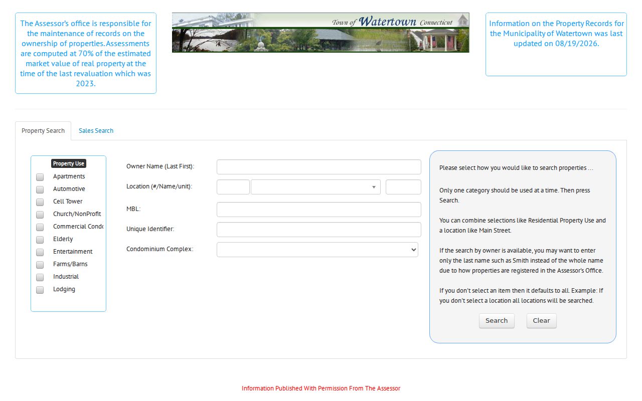
Those fields support a parcel-by-parcel pass, while the visible owner and mailing data still require cautious labels and custodian confirmation.
Note: If an address fails, try its unit, road-name variant, nearby number, MBL, or a direct GIS parcel click before ruling it out.
Watertown Voters Are Not Neighbors
Connecticut's official voter lookup requires a town, first name, last name, and full date of birth. Its described response can include status, party affiliation, polling location, and absentee-ballot-received status. That design verifies a person already known to the searcher. It cannot be opened as a list of everyone on a Watertown block.
The centralized voter file is also not a casual neighbor directory. A statewide file request costs $300 and is limited to specified election-related, scholarly, journalistic, political, or governmental uses. It bars personal, private, commercial, marketing, and harassment uses. Month and day of birth are exempt from the public disclosure context described by the state, and privacy-program records can be withheld.
Contact the Watertown Registrars of Voters for a correction or local election question. Do not infer that a parcel owner is registered there, or that a failed name lookup means the person is not a Watertown resident.
Watertown Neighbor Groups Add Context
No current municipal directory of every Watertown neighborhood association, HOA, block group, or civic district was located. The right fallback is to label local organizations by their real scope. They may name projects, meeting places, or community interests. They do not establish who occupies each home.
Watertown-Oakville Chamber
Member and community network serving the two postal identities. It is an umbrella business organization, not a municipal neighbor roll.
Water-Oak Circle of Sports
Community sports group serving Watertown and Oakville since 1977, with open meetings and local projects.
Watertown Garden Club
Civic and conservation group that meets at Union Congregational Church in Oakville.
Lake Winnemaug History
A 1990 Town Times item records association and special-tax-district context for that area.
The Chamber source is the successful manifest image assigned to the community layer.

The capture documents an active Watertown-Oakville umbrella resource without turning its membership into a list of nearby households.
Postal Clues Around Watertown Neighbors
Watertown and Oakville share one municipality but use different postal labels. Watertown's primary postal place is 06795, while Oakville uses 06779. That split is a useful search clue when a mailing field differs from the town name. It does not define a neighborhood, parcel edge, or municipal boundary.
The USPS Watertown location page is the assigned postal source for block context.
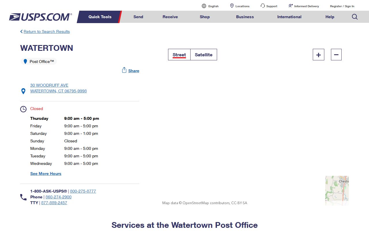
The postal listing helps confirm the Watertown label while the parcel map and assessor remain the tools for immediate adjacency.
Utility geography can cut across the same area in a different way. A home can sit in a named service zone, use an Oakville mailing label, and remain within Watertown. Record the parcel municipality, postal city and ZIP, owner mailing address, and service zone in separate fields.
Compare Watertown Neighbor Tools
Official records answer narrow questions and identify their keeper. Commercial neighbor tools combine data from many feeds, often without a clear date or role. That convenience can hide stale addresses, duplicates, and mistaken family links. Use the custodian record when a detail matters.
| Source type | Strength | Limit |
|---|---|---|
| Assessor and GIS | Current parcel identity and map relationship | Does not prove occupancy or legal survey lines |
| Town Clerk deed | Recorded parties and legal land description | Does not list all household members |
| Historical archive | Dated local context and scanned source page | Coverage has gaps and OCR can miss names |
| Commercial category | May collect broad hints quickly | Source dates, roles, and corrections may be unclear |
For corrections, contact the assessor, Town Clerk, registrar, archive, or private publisher responsible for the specific result. Removing a private listing does not change an official parcel or deed record.
Keep a short audit trail for every Watertown block check: source name, access date, exact field label, parcel key, street and unit, and what the record does not prove. That note becomes vital when a card is updated or a map layer changes. A deed's grantee, an assessor's displayed owner, and a civic-group member can be three different people. If the question concerns legal ownership, obtain the recorded instrument. If it concerns past community life, preserve the scanned article or directory page. If it concerns current occupancy, public parcel data may not answer it at all. Leaving that result unresolved is more accurate than filling the gap with a commercial profile.
Protect Watertown Neighbor Privacy
Connecticut's Safe at Home program can provide a substitute address and suppress a participant's street, house, and town address from the official voter registry. A separate voter privacy route can hide a record when disclosure would endanger the person or family. Treat a substitute or hidden address as a firm boundary, not a clue to reverse.
Use the least personal detail needed. Do not publish a full date of birth, protected address, private phone number, email, or Social Security number. Keep “owner,” “mailing contact,” “registered voter,” “historical directory entry,” and “neighboring parcel” distinct. If a record is wrong, the custodian's correction process is the proper route.
Lawful use. Neighbor research supports civic curiosity, reconnection, and personal safety. Never use public records to watch, intimidate, stalk, harass, or harm anyone.